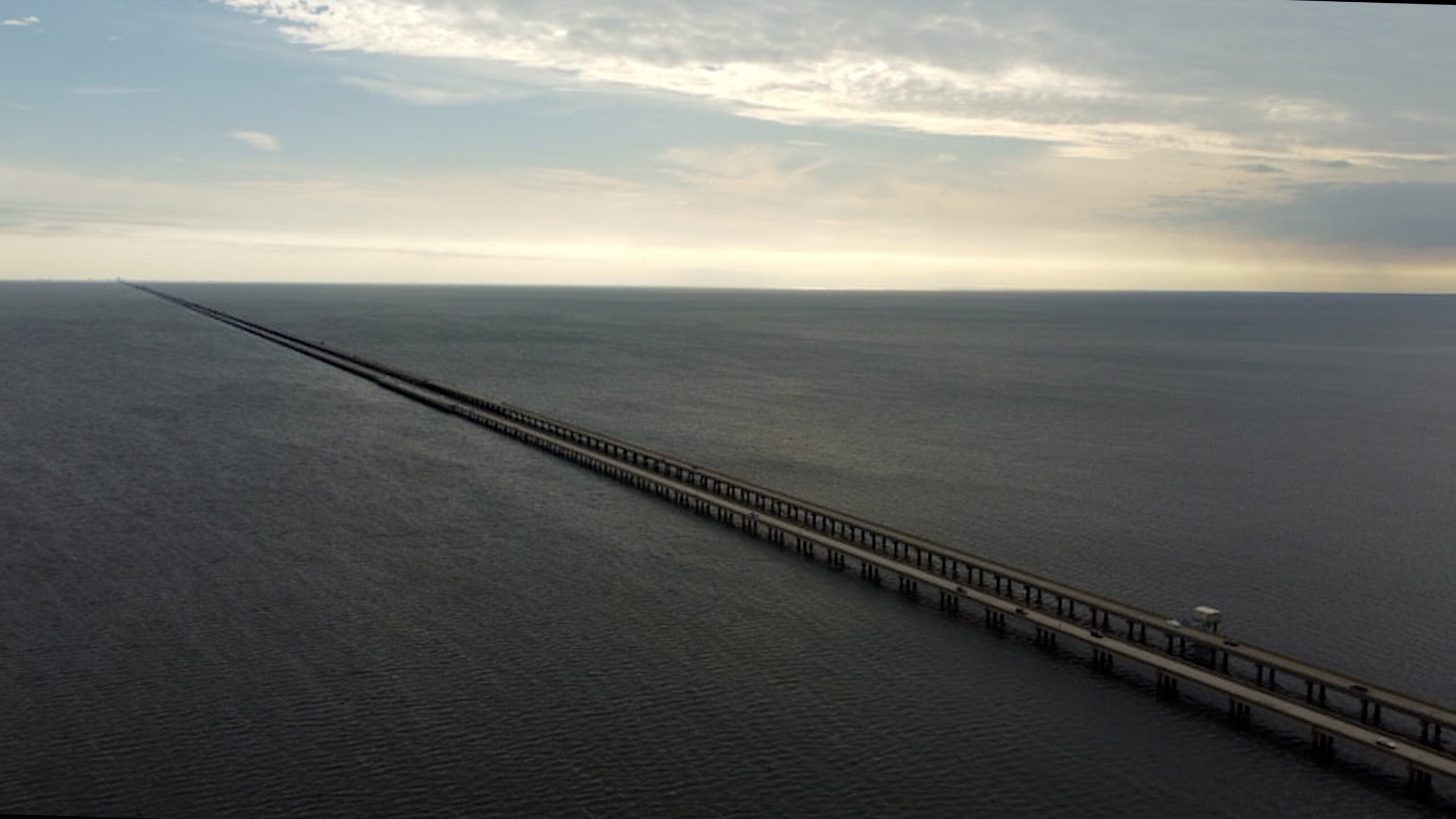
This is the world’s longest bridge over water. Its 9,500 concrete pillars support 4 lanes of high-speed traffic along a mind-numbing 23.8 miles or 38.3km (91% of a marathon), all of this a mere 15 feet (4.5m) above a shallow estuary lake.
The Lake Pontchartrain Causeway connects the 13,000 people of Mandeville, Louisiana to New Orleans. For 116 years, people would take a ferry or drive around the lake. Today this marvel of engineering cuts the drive from Mandeville to Bourbon Street from 56 minutes down to… 43 minutes? Costing $580 million in today’s money to save 13 minutes for 13,000 people? Surely there’s more to it than that…
Controversy over longest bridges
This seems like a simple question, but what is a bridge? We can all agree on what is normally a bridge, but it gets tricky when looking at the longest, shortest, and other outliers. Merriam-Webster says it’s a structure carrying a pathway or roadway over a depression or obstacle. In this case, we’ll get picky about whether a bridge is the part over an obstacle, whether it’s the whole structure, and whether a tunnel can be part of a bridge.
While the Lake Pontchartrain Causeway is the longest bridge in the United States at 23.8 miles, China might take issue with me calling it the world’s longest. When the Jiaozhou Bay Bridge was finished in 2011, it spanned 16.1 miles (25.9 km) over the bay. However, its other viaducts and structures over land brought the total length to 26.5 miles (42.6 km). Guinness World Records addressed this controversy by dividing the superlative into two categories: continuous and aggregate lengths over water. Similarly, the Hong Kong–Zhuhai–Macau Bridge is 34 miles (55km) long, but that includes the main 14.2 mile bridge span, a 4.2 mile tunnel, and 15.8 miles of link roads on either end.
Building the Causeway
What inspired this causeway, and why go to all this effort to save 13 minutes for a bunch of Louisianans? People have long dreamed of making it easy to cross Lake Pontchartrain. In the early 1800s, Bernard de Marigny (the founder of Mandeville) founded a ferry service. Mandeville became something of a weekend destination for workers from New Orleans. In the 1920s, ideas were floated to build artificial islands in the lake connected by a series of bridges. This would have been funded by selling real estate on the islands.
The causeway as it exists today was proposed by Ernest M. Loëb Jr., president of the Board of Commissioners of the Port of New Orleans. Try fitting that on a business card! Built by the Louisiana Bridge Company, the first causeway was simply a two-lane road elevated above Lake Pontchartrain. It cost $46 million in 1956, equivalent to $390 million in 2023 dollars, and the project also included multiple approach roads. The second parallel span opened in 1969 at a cost of $30 million, or $190 million in 2023 dollars.
Who uses the Causeway?
The causeway has always operated as a toll bridge, and roughly it collected over $25 million in tolls in fiscal year 2024. Some locals say this is why it’s one of the state’s most functional pieces of infrastructure. At $6 per round trip or $3.40 with a toll tag, that amounts to around 43,000 round trip crossings each day.
In addition to the city of Mandeville, the bridge made commutes to New Orleans accessible for Covington, Abita Springs, and other north shore communities. This capacity induced demand, and those communities grew considerably in the later half of the 20th century. Many residents of St. Tammany Parish could now drive downtown in under an hour during off-peak times. Without the causeway, these commuters need to drive around the lake through Slidell on the east or Manchac on the west. Is the causeway safe to cross, though?
What’s a causeway?
What’s a causeway again? It’s a raised road above a wetland or other low obstacle. It doesn’t necessarily have to be a bridge, either. Derived from the Latin word calx, meaning “heel,” ancient Romans would stomp to compress dirt onto the foundation until it was high and compact enough to avoid the obstacle.
Safety and Accidents
In 1964 two barges carrying gravel crashed into the bridge and tore a 224-foot gap. A Continental Trailways bus plunged into the lake, killing 6 passengers.
There are also no exits on the bridge. Once you’re on it, you’ve committed to driving the full length or using an emergency turnaround and returning. Fog and other inclement weather can reduce visibility and make it difficult for emergency services to reach you if you have a breakdown or accident.
On average there are between 100-200 crashes and 3,000-4,000 breakdowns per year on the causeway, though proportionately this is similar to other comparable stretches of road.
Driving 24 miles in a straight line tempts some drivers to focus on distractions such as cell phones, though there are longer stretches of straight highway. Highway 10 in Saudi Arabia has no curves for 159 miles or 256 kilometers. The Lake Pontchartrain Causeway, though, does not have shoulders or emergency lanes through the length of the road. It has 12 shoulders for drivers to pull over to (about 1 every 4 miles) and several vehicle turnarounds staffed by police. Check out my dashcam video if you’re curious about these.
Ultimately the Lake Pontchartrain Causeway has had a lasting impact on St. Tammany parish and the north shore communities. The entire region is more interconnected, and communities sprang up as they were brought into the metro area.